
Allen County ZIP Directory Areas
The official Allen County GIS ZIP layer returns 30 ZIP and community pairs. It supplies a geographic label, not the name of a post office. Fifteen rows use Fort Wayne, while the rest use smaller places or nearby mailing communities. The Allen County ZIP code directory must keep those labels separate from incorporated borders. A GIS row can touch Allen County without placing every address in that code inside the county.
| ZIP Code | Areas Covered | Post Office | Notes |
|---|---|---|---|
| 46706, 46723, 46733 | Auburn, Churubusco, Decatur edge areas | Verify by exact address with USPS | May cross municipal or county lines |
| 46741, 46743, 46745 | Grabill, Harlan, Hoagland | Verify by exact address with USPS | Community label is not a boundary |
| 46748, 46765, 46773 | Huntertown, Leo, Monroeville | Verify by exact address with USPS | Check township and incorporated area |
| 46774, 46777, 46783 | New Haven, Ossian, Roanoke | Verify by exact address with USPS | Ossian and Roanoke have split-area cautions |
| 46788, 46797, 46798 | Spencerville, Woodburn, Yoder | Verify by exact address with USPS | County overlap is possible |
| 46802-46809 | Central, east, south, west Fort Wayne mailing areas | Verify by exact address with USPS | Includes eight numbered codes |
| 46814-46819 | Southwest, east, northwest, and south Fort Wayne areas | Verify by exact address with USPS | Includes 46814, 46815, 46816, 46818, 46819 |
| 46825, 46835, 46845 | North and northeast Fort Wayne areas | Verify by exact address with USPS | Use parcel layers for city status |
The county layer does not publish station, route, PO-box, or ZIP+4 fields. That gap matters. A community name cannot safely be turned into a station name. The full set covers 46706, 46723, 46733, 46741, 46743, 46745, 46748, 46765, 46773, 46774, 46777, 46783, 46788, 46797, 46798, and the Fort Wayne series shown above.
Population figures also belong to towns and census geographies, not to this postal table. Allen County's annual report lists Fort Wayne, Grabill, Harlan, Hoagland, Huntertown, Leo-Cedarville, Monroeville, New Haven, Woodburn, and Zanesville as separate municipal places. Those place counts should never be assigned wholesale to a mailing code. The safest ZIP record states what the county layer actually says, adds the access date, and leaves demographic claims to a matching Census geography.
Map Allen County ZIP Records
The Allen County GIS hub connects the ZIP layer with parcels, addresses, townships, subdivisions, incorporated areas, and streets. Query the ZIP layer first, then move to the parcel tied to the exact address. That join supplies the municipality and township context a mailing code lacks. The county map carries an approximate-data warning, so a layer should prompt a record check rather than settle a legal boundary question.
The official GIS screen shows where Allen County postal geography gets its geographic footing:
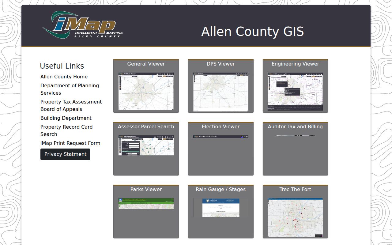
Use the hub to select the right viewer, then retain the map date, ZIP, community label, parcel PIN, township, and municipality in a research note.
The underlying ZIP service record exposes ZIP, COMMUNITY, and STATE as its useful public fields.
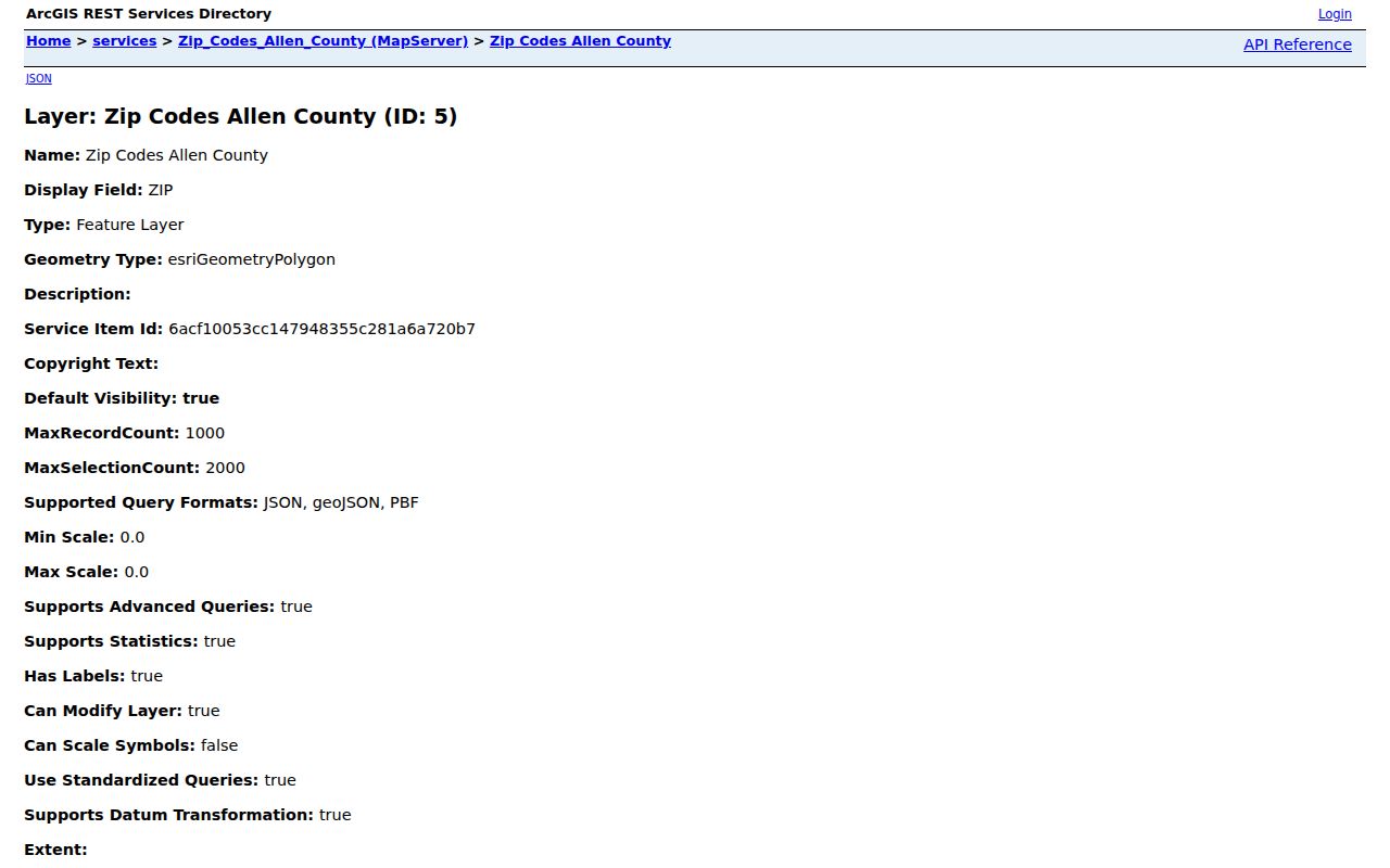
That compact field set explains why a ZIP map is strong for place context but cannot function as a resident roll.
Verify Allen County ZIP Addresses
The USPS ZIP Code Lookup is the final source for standardizing a mailing address. Its by-address mode asks for an optional company, street address, apartment or suite, city, and state. Separate modes search by city and state or by ZIP. The result confirms postal coding, not whether a named person or firm is now at the site.
The USPS form makes the distinction visible:
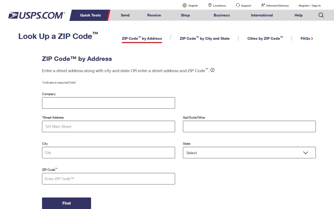
Copy the standardized address as returned, then compare it with the parcel card. If the mailing city and incorporated-area layer disagree, route city or county records by the parcel's actual jurisdiction.
This routing step is practical in Fort Wayne. City-limit permits and code records use city systems, while other county property records use county custodians. A postal answer cannot choose between them. Save the standardized address, then check the incorporated-area layer before sending a request. For an older address, compare the period directory or map too, since Fort Wayne's street numbers changed in 1902 and historic wording may not match a modern postal format.
Search Allen County Residents by ZIP
No official portal found in the research creates a public roster from one ZIP. The practical method moves from postal area to an exact official record. The Assessor card and GIS results can display a ZIP with a known parcel. The Indiana licensing search offers county and Zipcode fields. INBiz can expose an entity address, but a business address is not proof of a person's home. Indiana Voters does not accept a ZIP at all.
- Confirm the ZIP and community in county GIS. Keep the query date.
- Validate the full address with USPS. Do not infer a person from the postal result.
- Open the parcel by address or PIN and note its municipality, township, and owner-of-record label.
- Use a name in a suitable official index, then match its date and address. Stop if the evidence points to a different person.
Once the search narrows to a road, the Allen County street directory covers the address-level record chain without turning the entire ZIP into a name list.
For a focused public-record request, name the office, record class, date range, person or parcel identifier, and desired format. Indiana's Access to Public Records Act opens existing public records, but it does not require an office to create a new directory of everyone in a postal area. The county may acknowledge a request, estimate time, redact excluded fields, or direct it to another custodian. A narrow parcel or document request is more useful than an open-ended ZIP roster request.
Allen County ZIP Search Fields
ZIP support varies by portal. A sound Allen County postal-area search keeps each control tied to its stated purpose instead of promising a single ZIP-wide search.
| Official source | ZIP-related fields | Key limit |
|---|---|---|
| County GIS | ZIP, COMMUNITY, STATE | Geography only, no people |
| USPS | Address; city/state; ZIP modes | Does not confirm a person at an address |
| Assessor / COMPS | Address and PIN; ZIP may appear in results | No verified ZIP-only field |
| Indiana Voters | Name, birth date, county | No public ZIP field |
| PLA Search & Verify | County and Zipcode with name/license fields | Credential records, not a resident list |
The PLA data page documents downloadable license data and protected fields.
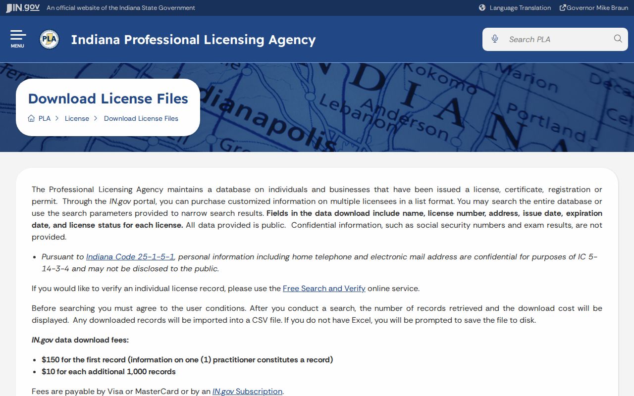
A ZIP match here should stay attached to the profession, license number, status, and access date shown by the state.
Join Allen County ZIP and Parcel
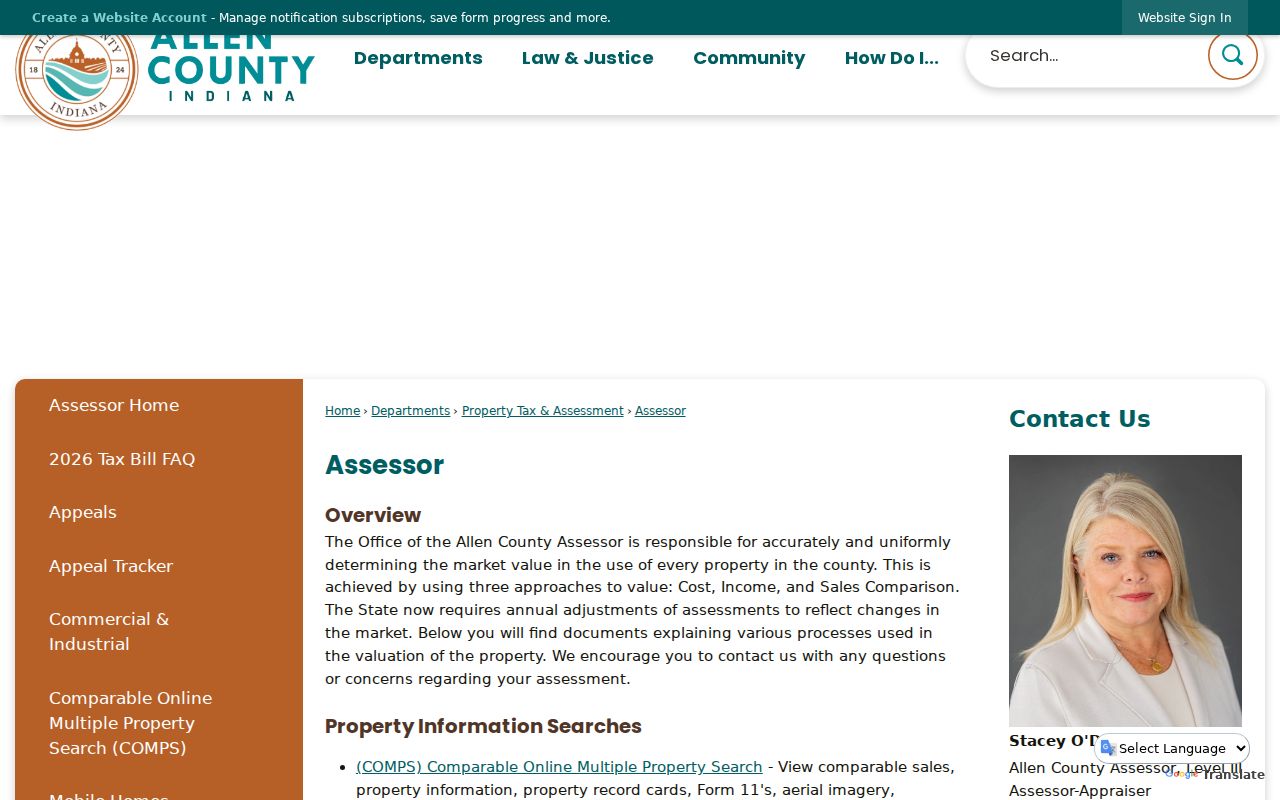
The Allen County Assessor explains the property-card route and links the map-based COMPS tool. Search by a less-specific street address or by PIN. Cards with transfers or value changes update monthly, so save the date. A parcel card may show owner, situs address, mailing address, municipality, township, subdivision, values, and transfer data. Ownership still does not establish who sleeps at the property.
The Assessor source used for this Allen County postal-area research is shown below:
Pairing a ZIP with the PIN is much more precise than pairing it with a surname. A PIN stays linked to a defined parcel even when owners, mailing labels, or assessed values change.
Record only the fields that answer the question. A useful parcel note has the PIN, property address, municipality or township, ZIP, owner label, source URL, and access date. A transfer date can explain why two systems differ, but the card should not be treated as a live occupancy report. If the owner label or address seems wrong, send the PIN and supporting document to the Assessor rather than publishing a guess about the resident.
Allen County ZIP Business Clues
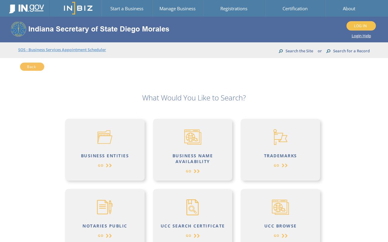
The INBiz public search can provide entity name, status, principal or registered-agent address, and filing history when available. Match the legal entity name and filing number before using a ZIP result. A registered-agent office can serve many entities and must not be relabeled as someone's private residence.
The state business interface gives Allen County postal research a second, narrow way to connect a known entity with a mailing area:
If archived filings are needed, INBiz describes information requests and notes that diligent archive or microfilm work may take 10 to 15 business days.
Allen County ZIPs Versus City Limits
Fort Wayne's official ZIP map shows postal areas beside the city boundary, while the current county GIS supplies the ZIP polygons. They answer different questions. A Fort Wayne mailing label may fall outside the incorporated city, and a small-community ZIP can cross a township or county edge. State geographic work flags partial-area cautions for 46777, 46783, 46788, 46798, and 46818, among others. Use that list only as a warning. Exact-address USPS and parcel checks decide which office should hold a local record.
- ZIP
- A five-digit postal delivery area. It is not a city, township, neighborhood, or county line.
- ZIP+4
- The five-digit code plus four digits that narrow mail to a smaller delivery segment.
- PO-box ZIP
- A code used for post-office boxes rather than ordinary street delivery.
- Unique ZIP
- A code assigned to one high-volume organization. None was verified in the county GIS table.
- Carrier route
- A postal delivery path within a ZIP. The county GIS layer does not publish it.
Boundary check. Never use a Fort Wayne mailing label alone to decide whether city or county staff hold an address record.
That boundary rule is the central safeguard of Allen County postal research. It keeps mailing geography, municipal authority, and evidence of residence from being merged into one unsupported claim.